How The GPS System Works
How the GPS system works
Since ancient times, people looked at the sky and tried to understand their position. In the past, sailors or tourists used to know the way from their place by looking at the stars in the night sky.
We still depend on the sky to know our position. But now satellites or artificial satellites are used instead of stars to know the position.
More than 30 navigation satellites are constantly orbiting the Earth. With the help of these satellites, it is possible to determine where exactly we are. This technology of positioning by satellite is called satellite navigation system.
GPS is a type of satellite navigation system operated by the United States government. Like the US, some other countries have their own satellite navigation systems. Russia's GLONASS, China's BDS and European Union's Galileo system also work in a similar way to GPS.
The full form of the word GPS is Global Positioning System. It is possible to know the location accurately from any part of the world through the GPS receiver device.
This GPS system for location determination can be used for free from any part of the world. All functions of GPS system mainly depend on 3 parts. They are: satellite, ground station and receiver.
A special type of satellite called a navigation satellite is usually used for positioning. Such satellites move at fixed speeds in their respective orbits. As a result, it is possible to determine the position of any navigation satellite from the earth at any time.
On the other hand, the communication with the satellite is maintained through the radar in the ground station. The exact location of any satellite can be ascertained through the ground station. There are currently 16 ground stations around the world to operate the GPS system accurately. In addition to certain regions of the Atlantic, Pacific and Indian Oceans, these ground stations are installed in South Korea, United Kingdom, Australia, Argentina, Bahrain, South Africa, Tahiti, Ecuador, New Zealand and some regions of the United States.
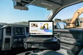
The third part used in a GPS system is the receiver. Many devices such as smartphones, notebooks and laptops manufactured today have a GPS receiver attached. GPS receivers are also installed in many vehicles. These receivers are constantly receiving signals sent from satellites in the form of radio waves. The distance of the satellites from which the signal is being sent is determined by the receiver.
When the receiver determines its distance from at least 4 or more navigation satellites, it is possible to determine the exact position of the user.
Each satellite stores accurate information about its specific position and time. When that information is sent to the receiver, the GPS user can know his exact location.
Every navigation satellite has an atomic clock to work accurately. The clocks on each satellite are synchronized with other satellites and Earth clocks. However, the clock has very subtle time variations. These variations are revised daily.
The entire GPS system is controlled from a master control station located in the US state of Colorado. Many technical aspects like the satellite's orbit and position are controlled from the Master Control Station.
In this way, the location of anyone on the surface of the earth is accurately determined through GPS. Various apps on devices like smartphones, laptops or tablets work through GPS. You can easily know your location with apps like Google Maps, Apple Maps, iGo, Maverick and Here.
There are also GPS trackers and other GPS devices available in the market for various uses. From knowing the location of one's own vehicle to making surveys or maps, these devices can be used.
In short, GPS technology has made our lives much easier. Where a GPS receiver is located, it is possible to know the precise location of the place from a few yards to a few inches. As a result, there is no fear of losing the way even in unfamiliar places, and favorite things can also be easily found with the help of GPS.
Source: NASA and Wikipedia

